
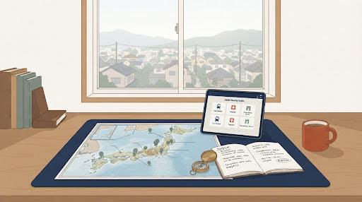
Researching a Japanese neighbourhood from ten thousand kilometres away
You can establish more about a Japanese location without leaving your desk than most buyers establish after visiting. Stations, schools, hospitals, shops, and the direction the population is moving are all public, free, and answerable in an afternoon.
In short
- Distance to a station is not the same as how long it takes to walk there, and in hill country the difference is large.
- Population trends show how an area has changed. They do not establish what will happen to local services.
- Some things only exist at a particular hour. Those are the ones to check in person, and they are a short list.
Start with the area, not the property
Most buyers find a house they like and then ask about the area. That is the expensive order. Researching the location first eliminates whole regions before you get attached to a photograph, and it costs nothing.
Our Japan Nearby Guide does the first pass: enter an address, a postcode or use your location, and it returns the nearest stations and what is around, across categories including hospitals, schools, shops and everyday facilities. It is free and it needs no account.
What follows is how to read what it gives you.
Stations
Japanese listings state distance to the station, conventionally converted to walking minutes at a fixed rate. Two things that convention does not capture.
It is measured along roads, not over terrain. An eleven-minute walk that climbs sixty metres is not an eleven-minute walk in July, or with shopping, or at sixty-five years old. Check the elevation difference as well as the distance, which is one of the things property research returns for a coordinate.
The line matters more than the station. How many trains an hour, where they go, whether the last one is at midnight or half past ten, and whether the line connects to anything. A station with one train an hour is a different proposition from one with twelve.
Passenger numbers give a rough sense of how much activity a station sustains. Treat that as context about the transport node, not as a measure of footfall past a particular address.
Everyday facilities
The list to check is short and the answers are decisive.
| What | What to establish |
|---|---|
| Food shopping | Nearest supermarket, and whether it is walkable. In rural areas this can be fifteen kilometres |
| Medical | Nearest clinic, and nearest hospital with an emergency department. Different questions |
| Schools | Catchment matters more than distance. Rural schools also close |
| Convenience store | A reasonable proxy for whether anything is open in the evening |
| Post office and bank | Still central to Japanese administration, and thinly spread in the countryside |
| Fuel | Where a car is necessary, the nearest station and its opening hours |
The emergency department question is the one people skip. A clinic ten minutes away is not the same as a hospital that will admit you at three in the morning, and in mountain areas the difference can be an hour.
Which way the population is moving
This is the single most useful piece of area data and almost nobody looks at it.
Municipal statistics record population, households and the proportion of residents over sixty-five, and they record them over time. Read together, they show how an area has been changing, which a single year's figure cannot.
- Population. Whether the number of residents has been rising, stable or falling, and how fast
- Age structure. How the share of residents over sixty-five has moved
- Households against population. Where households hold steady while population falls, more people are living alone or in pairs
These figures describe the past, not the future. They do not tell you whether a particular shop, clinic or bus route will continue, which is a question for the municipality and the operators themselves. What they do tell you is which places have been growing and which have been thinning, and two towns forty kilometres apart can be moving in opposite directions.
None of this is a reason not to buy in a rural area. It is a reason to know which rural area.
A single year's population figure is a snapshot. The trend over ten or twenty years is the information.
The physical setting
Some things about a location are properties of the ground rather than of the services on it.
Elevation and slope determine how the site behaves in heavy rain, how hard the walk to the station is, and whether snow will be a factor. Hazard designations tell you what has been modelled for the area and, just as importantly, what has not. Both are covered in Japan's hazard maps and what your broker must show you.
Land values, published annually, give a sense of direction. What comparable land has actually changed hands for is recorded separately and is usually more informative than the published figure.
What still requires a person on the ground
The desk research eliminates. It does not decide. A short list remains that no dataset holds.
- Noise at different hours. A road, a railway, a factory shift, a school. All silent in a photograph
- Light. Which rooms get sun in winter, and what the neighbouring buildings do to it
- Where water goes when it rains. Visible in twenty minutes of rain and in no document
- Smell. Agriculture, industry, drainage
- Whether the street feels occupied. How many houses nearby are themselves empty
- What the community expects. Shared maintenance duties, association fees, rotas. Rarely written into anything you will be shown
The last one matters in rural Japan more than overseas buyers expect. These are not obstacles, but they are commitments, and finding out about them after you arrive is a poor introduction. The full list of what only a visit answers is in what you must verify yourself before buying.
A sensible order
- Choose candidate areas and check population trend and services before looking at any property
- For a specific address, check stations, walking route, elevation and what is nearby
- Check hazard designations and terrain at the exact coordinate
- Look at recorded land values and transactions in the area
- Only then, shortlist properties
- Visit, at more than one hour of the day, and preferably in more than one season
Step six deserves emphasis for anyone considering somewhere with a real winter. Visit in February. Whether you can live with that particular winter is not answerable from a photograph taken in May, and it is the most common reason people regret a rural purchase.
What the data does and does not tell you
Facility listings, statistics and published values are drawn from public sources with their own collection dates and coverage. A facility that appears may have closed; one that does not appear may exist. Statistics describe a municipality, which can be large and internally varied.
This is general information, not an assessment of any area or property. En Beau lo does not act as a licensed real estate broker.
Start with the area, for nothing
Enter an address or a postcode in the Japan Nearby Guide and see the nearest stations and what is around. When you have narrowed it to a specific property, research the coordinate itself: zoning, hazard designations, terrain, land values and access, each with its source and reference year.
Research a propertySources and notes
Facility and station information is drawn from public mapping and transport data. Municipal population, household and age-structure statistics are published through national statistical channels. Published land values and recorded transaction information are published by the Ministry of Land, Infrastructure, Transport and Tourism. Hazard designations are published by prefectures and municipalities. Collection dates and coverage differ by source and are shown per dataset in our reports.